| |
|
About Curacao
Curacao is a long, arid, and generally flat island, stretching some 40
miles (64 km) from southeast to northwest, at much the same north-south angles as it's sister islands in the ABC group (Aruba to the
west and Bonaire to the east). The island is about 10 miles (16 km) at it's widest point, and the area is about 180 square miles
(472 square km), making it the largest island in the Dutch Caribbean Islands group.
The coastline along the south is irregular, peppered with small bays and
inlets, including the spectacular bays and beaches at the west end of the island. The largest bays are located along the
central-east and east end of the island, where you'll find the capital and major port of Willemstad. Most of Curacao's 130,000
residents live in and around this historic town.
The long north coast of the island, buffeted by constant northeast trade
winds, is characterized by a rough coasthne, limestone cliff formations set on top of eons-old volcanic rock, and
weather-beaten terrain. It is generally less inhabited than the south coast, but you will find smaller villages and many of the island's
famous landhuis, or old plantation house, structures here.
The west end of the island is also characterized by expansive, hilly
terrain, most of it encompassed by Christoffel Park. The 4,500 -acre (1,820-hectare) park contains Mt. Christoffel, at 1,239 feet (377
meters) the highest elevation on Curacao. The east end of the island comprises flat and mostly barren plain, with few settlements
and some secondary roads weaving to and from its coastal inlets.
With an average 20 inches (510 mm) of rainfall yearly, Curacao is
generally a dry island. There are few standing bodies of water save some saline ponds, and most of the island's water is provided by a
large desalinization plant found on the south coast.
|
|
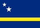
Curaçao Flag
|
Curacao's Coat of Arms
|
|
Anthem |
: |
Himno di Kòrsou |
| Capital |
: |
Willemstad |
| Languages |
: |
Papiamento, Dutch |
| Currency |
: |
Netherlands Antillean Guilder (NAF) |
| Time Zone |
: |
AST (UTC-04) |
| Airport Code |
: |
CUR |
| Internet TLD |
: |
.cw (before 10-10-2012 it was .an) |
| Calling Code |
: |
5999 |
| Electricity |
: |
110-130V/50Hz (North American plug) |
| Highest point |
: |
Sint Christoffelberg - 375m |
|
Where is Curacao on the map?
Curacao is a long, arid, and generally flat island, stretching some 40
miles (64 km) from southeast to northwest, at much the same north-south angles as it's sister islands in the ABC group (Aruba to the
west and Bonaire to the east).
Curacao Weather, Forecasts & Climate
Located in the tropics, just 12° north of the Equator -- and outside of
the hurricane belt -- Curaçao has a warm, sunny climate year round. The average temperature is about 27° C ( mid 80s F). Refreshing
trade winds blow constantly from the east, picking up in the spring months.
The rainy season, October to February, is marked by short, occasional
showers, usually at night, and continued sunny weather by day. Total annual rainfall averages only 570 mm (22 inches). Occasionally a
tropical storm brewing elsewhere in the Caribbean can cause uncharacteristically cloudy weather for a day or two.
Weather can't be forecast more than a week or so in advance, but weather
averages are good indicators of what to expect any month.
The languages of Curacao
Curacaons are, by nature and necessity, masters of language. Most native
speakers will use Dutch, English, and Papiamentu with equal aplomb. Dutch is the official language, while Papiamentu is the most
common. Spanish is also spoken by most Curacaons, and English is widely used.
Papiamentu (Papiamento)
A multifaceted Creole language, is based on Portuguese, Spanish, Dutch,
and several African dialects. It's spoken most often in the ABC Islands, and has been in use for 300 years. It is, in a way, the
original language of Curacao, and was meant to be a spoken communication, not a written one. For that reason, You'll often see
different spellings for the same words, not just among the ABCs, but on each island. For instance, Curacao spells the language's name
Papiamento, while Curacao renders it Papiamentu.
Papiamentu Words and Phrases
| Papiamentu |
Dutch |
English |
| Bon bini |
Welkom |
Welcome |
| Bon dia |
Goedendag |
Good day |
| Morru |
Goedenmorgen |
Good morning |
| Bon tardi |
Goedenavond |
Good afternoon |
| Bon nochi |
Goedenacht |
Good night |
| Ayo |
Tot ziens |
Goodbye |
| Con ta bo nomber? |
Hoe heet je? |
What's your name? |
| Mi nomber ta ... |
Ik heet ... |
My name is ... |
| Con ta bay? |
Hoe gaat het met je? |
How are you? |
| Mi ta bon |
Met mij gaat het goed |
I am fine |
| Danki |
Dank u wel |
Thank you |
| Masha danki |
Vele dank |
Thank you very much |
| Di nada |
Graag gedaan |
You are welcome |
| Mi dushi |
Mijn liefje |
My love |
| Mi ta stima bo |
Ik hou van je |
I love you |
|
The History of Curacao
In many ways, Curacao is the historical nexus of the Netherlands
Antilles. The island, with its large and protected natural port,
was charted before the 16th century and eventually became a major center
for mercantile commerce. It is the birthplace of Papiamentu
(as it is spelled on Curacao), the polyglot lingua franca of the ABC
Islands which is spoken to an extent as far north as the
Netherlands Antilles islands of Sint Eustatius, Saba, and Sint Maarten.
And the island is, on another level, the birthplace of the
famous liqueur, Curacao, perhaps more well known in some circles than
the island itself.
The history of Curacao begins with Amerindian Arawaks. The Arawaks and
their subgroups migrated from regions of South America some
6,000 years ago, settling on various islands the discovered as they
embarked on a centuries-long northward trek. The group that
ended up in Curacao were the Caiquetios, who gave the island it's name.
After the late-15th-century voyages of Christopher Columbus put the
Caribbean, literally, on the maps, the area was wide open for
European exploration. The Spanish soldier and explorer Alonso de Ojeda,
joined by the Italian Amerigo Vespucci, set out on a voyage
(1499 - 1500) to chart much of the South American coast and, in turn,
several offshore islands in the area. One was Curacao. As an aside, disputed claims are par for the course when it comes to Vespucci.
One of many stories has it that during his voyage with de
Ojeda, a number of sailors on his ship came down with scurvy, whereupon
he dropped off the hapless souls on Curacao on his way to
South America.
On his return, he found the sailors alive and happy-presumably cured by
the abundance of Vitamin C-laden fruit on the island. He
then is said to have named the island Curacao, after an archaic
Portuguese word for "cure". Of course, Vespucci was Italian, not
Portuguese, and de Ojeda was Spanish, but these stories seem to take on
a life of their own, and are often much more fun than the real story. A more convincing theory is that the Spaniards called the
island Curazon, for "heart", and the mapmakers of the day
converted the spelling to the Portuguese Curacao.
At any rate, soon after de Ojeda's voyage, the Spanish came in larger
numbers. By the early 16th century they had pretty well determined that the island had little gold and not enough of a fresh
water supply to establish large farms, and they abandoned it. Finally, the Dutch West India Company, a quasi-private,
government-backed company, laid claim in 1634. The company installed the Dutch explorer Peter Stuyvesant as governor in 1642, and he soon
established plantations on the island, each with its famous landhuizen-structures that can still be seen today. The plantations
foundered in various forms of agriculture, but some were successful in growing peanuts, maize, and fruits. They soon found their
niche in the production of salt, dried from the island's saline ponds. Within a few years after establishing the farming industry
and some form of rule on Curacao, Stuyvesant moved on to bigger shores.
With its deep port and protected shores, and with the establishment of
several large forts, Curacao soon became a safe place for the Dutch West India Company to conduct commerce. Chief among its endeavors
was the trade of slaves from Africa, who then went on to the
other islands of the Dutch West Indies and to the Spanish Main. It was
during the slave trade days that the language Papiamentu began to form. The language, a mixture of Portuguese, Spanish, Dutch,
and African dialects, became the main form of communication
between slaves and their captors.
Also during this time, Jewish families from Amsterdam established
settlements on Curacao and attracted others from Europe and South
America, fleeing from the remnants of the Spanish and Portuguese
Inquisitions. By the early 18th century, the Jewish population in
Curacao had reached 2,000. In 1732, the community established the Mikve
Israel Emanuel Synagogue in Willemstad, a structure that
stands today. It is one of the oldest synagogues in the Western
Hemisphere still in use.
During the early 18th century, the island's deep port and strategic
position attracted the British and French, who as always were
busy in the Caribbean, fighting over various islands in desperate
struggles to control the profitable trade routes and sugar
plantations of the larger islands. Brittain tossed out the Dutch twice,
from 1800 to 1803, and again from 1807 to 1815. The 1815
Treaty of Paris settled a lot of disputes in the Caribbean, and it gave
Curacao back to the Dutch West India Company. Soon after the
Dutch retook the island, it languished for a century. Slavery
disappeared, and social and economic conditions were harsh.
In 1920, oil was discovered off the Venezuelan coast. This signaled a
new era for Curacao, and for its sister island in the ABCs, Aruba. The two islands became centers for distilling crude oil imported
from Venezuela, and Curacao's Royal Dutch Shell Refinery became the island's biggest business and employer. Immigrants headed for
Curacao, many from other Caribbean nations, South America, and as far away as Asia. During WW II, the Allies judged Curacao and its
refinery to be important enough, and strategic enough, to establish an American military base at Waterfort Arches, near
Willemstad.
After WW II, Curacao joined the rest of the Caribbean in a loud clamor
for independence. What it got instead was a measure of
autonomy as an entity within the Kingdom of the Netherlands. Curacao,
along with, Bonaire, Saba, Sint Eustatius, and Sint Maarten,
became the Netherlands Antilles, with the administrative center in
Willemstad. Aruba separated from the other five islands on
January 1, 1986. Sint Maarten and Curacao became independed on October
10, 2010 and the islands of Bonaire, Saba and Sint Eustatius
became special municipalities within the country of the Netherlands.
|
|
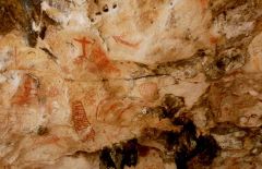 Drawing in Curaçao
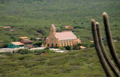 Church Sint Willibrordust
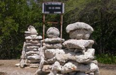 Slave Monument
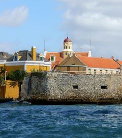 Fort Amsterdam
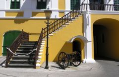 Canon at Fort Amsterdam
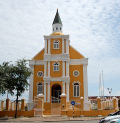 The Church of Fort Amsterdam
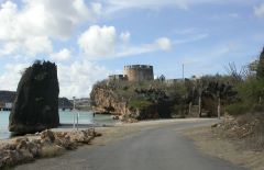 Fort Beekenburg
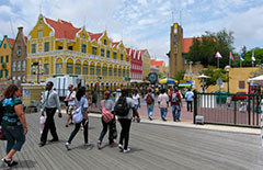 Punda Trade Harbour
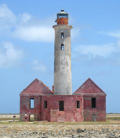 Lighthouse at Klein Curaçao
|
Curacao's Culture & Folklore
Curacao's 150,000 people spell the island Kòrsou, a Papiamentu word,
indicating a strong cultural sensibility. While Curacao was a member of
the Netherlands Antilles (till 10 October 2010, when the Netherlands
Antilles was dissolved), but has strong ties with Holland, the island is
more African and cosmopolitan, more Caribbean, in its culture than many.
The society has strong ties to its African memories through language,
music, and dance.
One of Curacao's strongest manifestations of its African past is "tambu",
an ancient form of music and dance. Slaves carried the traditional,
rhythmic structure of the form from Africa and passed it along, by ear,
from generation to generation. Drumming is the foundation of tambu, and
the first instruments used by slaves in Curacao were farm implements.
Later they converted small, hollow cargo containers covered with dried
goatslun into drums.
Accompanying the rhythm is a form of dancing called "baila ban" (dance
the drum) where partners never touch each other but move their hips and
bodies to the rhythm while leaving the feet in place. Despite being
banned by slave masters, and later by the Catholic church, the dance has
survived. Today you'll see tambu drumming and dancing at cultural
festivals, at Carnival time, and at folklore performances around the
island. An annual Festival of Tumba gathers musicians from around the
island, where they compete to have their song selected as a road march
for Carnival.
Other musical instruments with their roots in Africa have found homes on
Curacao. The "bastel" is a horn made from, literally, a cow horn. The "chapi"
is played with a hoe and long metal rod, like a nail. The "karko" is a
conch shell, drilled and used as a horn. The "benta" is a twig from the
local "karawara" bush, fastened at either end with string, and bent to
form a bow. The bow is placed in the mouth and the player taps the
string, creating a twang, sort of like a Jew's harp. This instrument is
often used in a twangy musical form called "zumbi", which refers to
zombies. This points out another aspect of Curacao culture the archaic,
spirit-based religions that remain strong among all people of the
Caribbean of African descent.
Along with African-based dances, Curacaons have adapted the European
music and dances of the colonials and made them their own. The French
quadrille, waltzes, and polkas have embraced the syncretic jolt from
Africa and are now performed with a rhythm that Peter Stuyvesant would
never recognize.
|
|
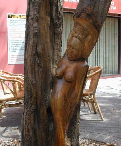 Tradicional Tree Art
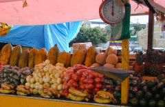 Floating Market
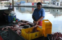 Fish Market
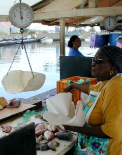 Fish Market
|
Nature: Flora and Fauna
Flora
Cactus: If there's one word that describes Curacao's most prevalent
plant, it's cactus, and the island hosts hundreds of species. The
towering Kadushi Cactus is more like a multi-trunk tree with thousands
of needles. The Yatu Cactus is also tall, sometimes as much as 30 feet,
but has fewer needles, and is often used to make fences. You'll find
both these species in abundance all over the island, in places so tall
they fall over from their own weight.
The prickly Pear Cactus, Turk's Cap, and many others, some as small as a
pebble, are prevalent all over the island. Acacia bushes, scraggly trees
with small green leaves and long, hard thorns, are also numerous, as is
aloe vera, with its pale green, waxy leaves.
The island is also home to the Divi Divi Tree, the famous leaning tree
of the ABC Islands that looks like a cartoon rendition of a stretched
tree bowing to an audience. Indeed, the tree is bent by years of
exposure to the trade winds that blow from east to west across the
island. Por that reason, the tree always "points" to the west.
Fauna
The island is subtropical and semiarid, and as such has not supported
the numerous tropical species of mammals, birds, and lizards most often
associated with rainforests. But birders will not be disappointed by the
dozens of species of hummingbirds, bananaquits, orioles, and the larger
terns, herons, egrets, and even flamingos that make their homes near
ponds or in coastal areas. The trupial, a black bird with a bright
orange underbelly and white swatches on its wings, is common to the
island and to Curacao. The mockingbird, called chuchubi in Papiamentu,
resembles the North American mockingbird, with a long white-gray tail
and a gray back. Near the shore, note the big-billed brown pelicans that
dive, straight down like dead weight, into the ocean after fish. Other
seabirds include several types of gulls and large cormorants.
Of mammals, other than some field mice, small rabbits, and cave bats,
Curacao's most notable animal is the white-tailed deer. This deer is
related to the American white-tailed deer, or Virginia deer, found in
spots from North America through Central America and the Caribbean, and
as far south as Bolivia. It can be a large deer, some reaching six feet
(two meters) in length and three feet (one meter) in height, and
weighing as much as 300 pounds (136 kg). In Curacao you'll be able to
identify it by its long tail with a white underside, and because it's
the only deer you'll see on the island. It is a protected species (since
1926), and an estimated 200 live on Curacao. They're found in many parts
of the island, but most notably at the west end's Christoffel Park,
where about 70% of the herd resides. Archaeologists believe that the
deer was brought from South America to Curacao by its original
inhabitants, the Arawaks.
You'll also find several species of iguana, light green in color with
shimmering shades of aqua along the belly and sides, lounging in the sun
here and there. The iguanas found on Curacao are not only nice to look
at, but, unlike many islands that gave up the practice years ago, remain
fodder for the dinner table. Along the west end of the island's north
shore are several inlets that have become home to breeding sea turtles.
These turtles are protected by the park system in Shete Boka Park, and
you can visit the moms-to-be in the mornings, accompanied by park
rangers.
|
|
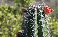 Cactus
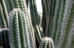 Yatu Cactus
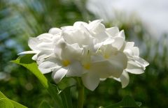 White Flower
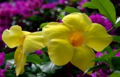 Yellow Flower
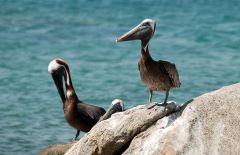 Pelicans
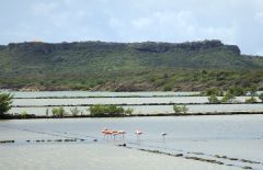 Flamingos
|
Churches & Religions
There about four world religions, which are present on the island:
Christianity, Islam, Judaism and Hinduism. Tourists are welcome at all
churches but for English speaking churches are on the island: the
Anglican Church, the Ebenezer church (member of the Untited Protestant
Congregation) and the Methodist church.
Pleae find more information about religions and churches:
www.curacao.faithweb.com
|
|
 Inside the Church
|
Medical Facilities, Doctors and Hospital
Although Curaçao is less humid than many Caribbean islands, mosquitoes
can occasionally be a problem in the rainy season and at night.
Repellent can be purchased at pharmacies and supermarkets. Curaçao has
no malaria or similar tropical diseases, and no vaccinations are needed
to visit.
Due to the high level of overall hygiene and cleanliness,
gastro-intestinal complaints ("travelers' tummy") are very uncommon. Eat
and drink freely. For minor ailments, standard US and European
over-the-counter medicines are available at the local pharmacies, called
"Botica's". There are a number of medical of medical centers on the
island. the St. Elisabeth Hospital is the most modern and well equipped
in the region.
Hospital on Curaçao:
St. Elisabeth Hospital
Tel:+(5999) 462-4900
Emergency number: 910
E-mail: info@stelisabethhospital.com
Dialysis center:
Curaçao Dialysis Center
Klipstraat, Otrobanda
Tel: +(5999) 434-7777
Fax: +(5999) 434-7701
Website: www.curacao-dialysis.com
Dentists:
Centro Dental Mahaai
Anjelierweg 6
Tel: (+5999) 737-0285
Fax: (+5999) 736-9033
Website: www.dentist.an
Dental Clinic Chong and Associates
"Esther Building"
Caracasbaaiweg 164, Unit 7
Tel: (+5999) 461-6665
Fax: (+5999) 461-8249
Website: www.dentalclinicchong.com
|
|
|
Economy & Government
Government
Per October 10, 2012 Curaçao is an autonomous country within the Kingdom
of the Netherlands. The locals have Dutch nationality and carry Dutch
European Union passports.
The form of government is a parliamentary democracy, based on underlying
premises such as freedom of association, the right to form political
parties, freedom of the press, and freedom of speech.
Curaçao has two levels of government-a central (federal) and an insular
(territorial) level.
The Central Government's jurisdiction covers mostly state affairs
(legislation) and includes police, communications, taxation, public
health, education, economic control, the establishment of enterprises,
labor legislation, money and banking, and foreign currency.
The Island Government is responsible for the island territory affairs;
it manages its own territorial affairs and has the power to enact laws.
The island government is responsible for the infrastructure, harbors,
airport, etc.
Economy
In modern times, Curaçao has expanded its infrastructure and modernized.
The refinery is still big business, and now a large desalinization plant
provides the island's potable water. The capital Willemstad has grown as
well, and in the post-WW II period, the city experienced tremendous
growth. Jn addition to other changes, bridges were added to provide easy
access between the two downtown sections of the city, Punda and
Otrobanda, which are separated by the Sint Annabaai (St. Anna Bay)
channel.
Revenues on the island are dependent services and family transfers from
Holland, oil refinery earnings (representing more than 90% of all
exports), offshore banking, and tourism. Curaçao's tourism is still
growing, but it is that aspect of the island that makes it so appealing
to many. About 220 cruise ships call yearly, and nearly 260,000
tourists, most from Europe and specifically the Netherlands, visit each
year.
Contents of this page are from the website
http://www.curacao-travelguide.com and can change in time. If you need
more information about Curaçao, please visit the website. You can also
visit http://www.curacao.com.
|
|
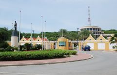 Central Bank
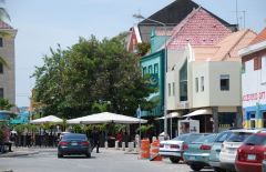 Punda
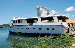 Harbour - Shipyard
|
|
|


